Pissouri (Pissoúri)
Now they are two distinct communities, Pissouri Village Area and Pissouri Bay Area. The total permanent population is said to reach around 1100 people, about half of whom are Cypriots, the rest foreigners, mainly British, residents and visitors.
There are several shops, and many tavernas, restaurants and bars in the village. There is also a Bank of Cyprus branch in the village's central square.
According to some official sources, the name Pissouri derives from the ancient city ‘Voousoura’, as reported by Stravonas, a 1st-century BCE - 1st-century CE philosopher, mathematician and geographer. Some other sources connect the name of the village with pitched-dark nights.
A legend reports that the 300 Alamanoi (German) saints who came to Cyprus from Palestine in order to practice in various parts of the island, arrived on the Pissouri’s coast during such a pitch-dark night. Another legend reports that ‘the Saint Fathers’ pursued during the post-Christian era, were met in Pissouri’s region during a really black-night. However, it seems that the name of the village does not eventually stem from those legendaries but from the fact that in the region there was an extensive extraction of skin-sap from pine trees (called ‘pissa’ in Greek). The skin-sap production begun during the Byzantine Empire (Eastern Roman Empire), continued during the Middle-Ages (5th – 15th century) and the Frankish era in Cyprus.
Map - Pissouri (Pissoúri)
Map
Country - Cyprus
 |
 |
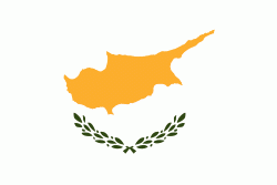
| Flag of Cyprus | |
The earliest known human activity on the island dates to around the 10th millennium BC. Archaeological remains include the well-preserved ruins from the Hellenistic period such as Salamis and Kourion, and Cyprus is home to some of the oldest water wells in the world. Cyprus was settled by Mycenaean Greeks in two waves in the 2nd millennium BC. As a strategic location in the Eastern Mediterranean, it was subsequently occupied by several major powers, including the empires of the Assyrians, Egyptians and Persians, from whom the island was seized in 333 BC by Alexander the Great. Subsequent rule by Ptolemaic Egypt, the Classical and Eastern Roman Empire, Arab caliphates for a short period, the French Lusignan dynasty and the Venetians was followed by over three centuries of Ottoman rule between 1571 and 1878 (de jure until 1914).
Currency / Language
| ISO | Currency | Symbol | Significant figures |
|---|---|---|---|
| EUR | Euro | € | 2 |
| ISO | Language |
|---|---|
| EN | English language |
| EL | Greek language |
| TR | Turkish language |


